• Watch Out for Scammers!

    We've now added a color code for all accounts. Orange accounts are new members, Blue are full members, and Green are Supporters. If you get a message about a sale from an orange account, make sure you pay attention before sending any money!

Anyone using drones to determine winds?

Bandit320

Gunny Sergeant
Full Member
Minuteman
Sep 1, 2018
745
2,028
Missouri
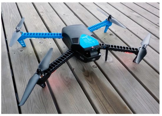
I read on a thread about someone using a drone to determine down range winds for ELR shooting. I’m sure there are some high end ones that do that, but I was wondering if anyone is using somewhat entry level drones to do so.

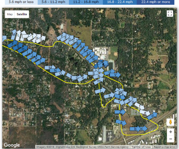
I have a DJI Mini II. It has a rudimentary attitude indicator (of sorts, not exactly like an aircraft unit) that would probably let you estimate wind direction to within one clock position and speed up to the max speed of the drone. Here is a YouTube video describing the process.


Does anyone have a better way of getting a more exact wind speed? Are there other models of drones that give a better indication? Thanks.

Mike
 
The better way is with an actual meter, but given is "request quote" for drone models likely not consumer affordable:

I suggested something like this a while back as the sensors like the calypso nearing the $250 range making this a possibility. Vitalbo mentioned during the MDR summit that they had such a system in testing using multiple drones. Again given their primary .mil market won't be anything the consumer will likely see.

As to the accuracy of using onboard sensors, 1/2 MPH is claimed which is pretty good, ~4-5 degrees on direction less so, but still usable.
A few white papers on this subject:


I’m not a software kind of person but I would think they (the drone manufacturer and engineers) should be able to display a field useable indication of the wind. They can hover motionless with the GPS and have computed values for pitch, roll, and power settings. Shouldn’t be that hard.

Skimming the drone forums there doesn’t seem like much demand for it, and there seems to be quite a bit of disdain for anyone who wants it.
 
It’s not as easy as it sounds, in a practical sense. Extracting a motion vector from a force is trivial, but trying to isolate the force on a drone, with all of its turbulent features, would be far from trivial. It would be much easier with something just floating like a balloon because you just subtract two position vectors at different time intervals to determine a force vector (direction and magnitude). But a balloon is extremely limited. So now you try a drone by making it hover with multiple rotors constantly applying corrective forces and then do the same vector operation. How do you know the motion is 100% from the wind and not a bias from the rotors?

Why not just add a wind sock at the target and calibrate it with an anemometer?
 
If read the whitepapers they actually do know it from built in sensors, DJI's already log wind speed and can see it with several apps but only after the fact.

wind_map_2-highres.png


DJI has said "we'll think about it" when asked if they would add it to the built in attitude display for at least 5 years now based on several forum threads there.
 
  • Like
Reactions: Kris and Bandit320
If read the whitepapers they actually do know it from built in sensors, DJI's already log wind speed and can see it with several apps but only after the fact.

wind_map_2-highres.png


DJI has said "we'll think about it" when asked if they would add it to the built in attitude display for at least 5 years now based on several forum threads there.
Built in sensor is a rotation speed on the rotors and wind speed is derived from the differential needed to maintain position in relatively level flight. It isn't like an anemometer is going to do anything good on something covered in high speed fans. The short answer is that yes, a drone can give you the data but only where it is at that moment because a wind history map is a collection of moments across time which is why the two sides of the map don't line up well.

-Alex
If read the white papers and also DJI's own info on what their attitude sensing does it can provide wind speed simply by hovering.
Is what their "too windy to fly" alert triggers on. The rub is they have so far refused to display the actual value in their app.
 
Technology coming to help us all.

Supposedly, we'll see