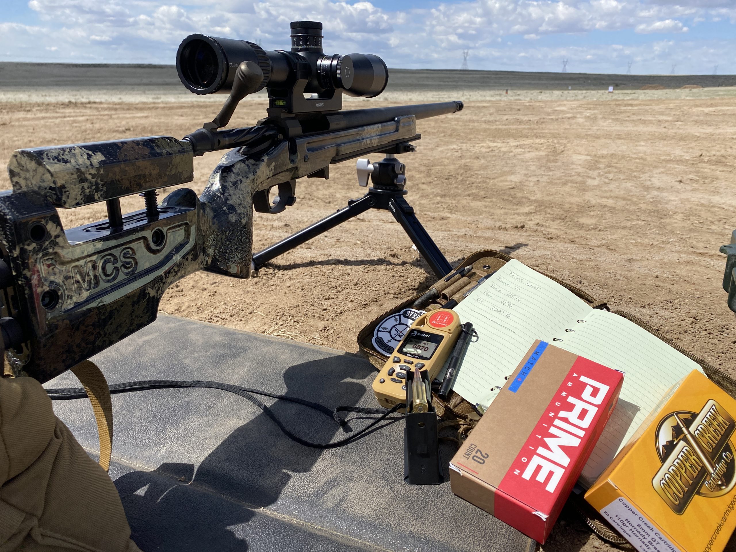
So I have a vague idea what density altitude is.
Its a combination of a majority of external factors like altitude, temperature, pressure and few other to simulate an altitude that would equate to all these combined.
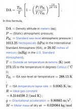
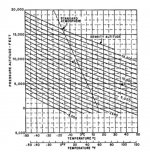
What I don't know is how to get it, either through math or some gizmo gadget, can someone point me in the right direction?
Its a combination of a majority of external factors like altitude, temperature, pressure and few other to simulate an altitude that would equate to all these combined.
What I don't know is how to get it, either through math or some gizmo gadget, can someone point me in the right direction?