• Watch Out for Scammers!

    We've now added a color code for all accounts. Orange accounts are new members, Blue are full members, and Green are Supporters. If you get a message about a sale from an orange account, make sure you pay attention before sending any money!

Mark a straight line in the woods?

Cat_D11_View_2.jpg
 
OK, maybe not a transit and laser -- but OP may require at least one or two other people if you're going by Mark 1 Mod 0 eyeball and not something as primitive as a compass and chains.

He's got to lay out his line before clearing the first tree or bush if he doesn't have line-of-sight. How do you do this with a phone or GPS?

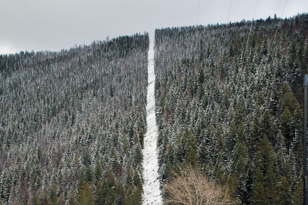
Lewis and Clark surveyed the west with chains. The photos below are the US-Canadian border. Imagine surveying that with a ball of string and a compass.
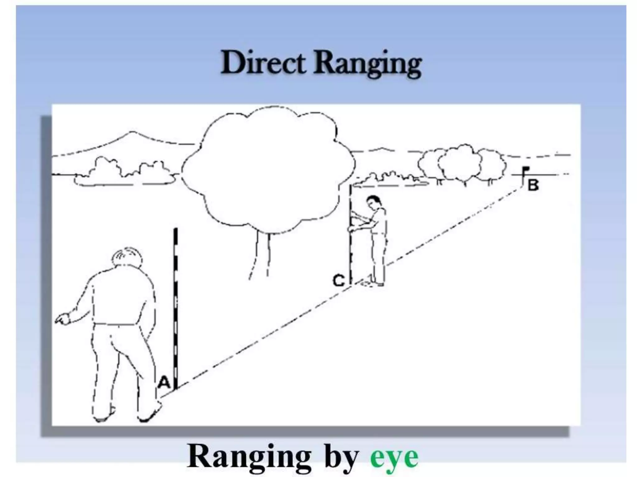
ranging-170811123447-3-2048.jpg
r7021e0k.gif
BCCanadaBorder_winter.jpg

o9tt0yrer5191.jpg


I still think the lasers, and string lines are more than enough.

The OP is only going 300y and there’s a hill…that I presume is higher than the brush….

If this was miles in a jungles deep canopy, I could see mapping, GPS, or otherwise complicating it.
 
Okay, so main reason that I’m following is that we may need to do this same thing, but over varying terrain and elevations and out past a mile. Including water holes and other obstacles. Not everbody has unlimited time and resources to just go crashing about, hoping to get it right by the time they go broke.

I’m well aware that people have been doing this since man started claiming land as theirs. Simplest methods, that work most efficiently, at lowest cost are within our grasp today, so any information is good information.
 
Exactly, find a surveyor who likes to shoot and barter.
Great idea , those guys are a dime a dozen .:rolleyes:

OP , Like I posted above . All you need is a roll of flagging tape and a rough direction to head . 3 poines on line will not lie , you can not go too far astray or you will not be able to line them up visually . This is as simple as it gets in the survey world . You can have as little as 25 feet between flags in the bush and can stretch that distance out in the clearer areas . You can take a piece of flagging and hold it vertical to use as your plumb bob, once you have all 3 flags in line put the one in your hands on the closest branch/tree/etc. and jump ahead as far as possible while still keeping two flags visible behind you . You can tweak the flags/line as you clear later .
 
If using a compass, take a backsight on your point of beginning as you progress. Should be exactly 180* opposite of the azimuth you're following.
 
Okay, so main reason that I’m following is that we may need to do this same thing, but over varying terrain and elevations and out past a mile. Including water holes and other obstacles. Not everbody has unlimited time and resources to just go crashing about, hoping to get it right by the time they go broke.

I’m well aware that people have been doing this since man started claiming land as theirs. Simplest methods, that work most efficiently, at lowest cost are within our grasp today, so any information is good information.
I can understand the need to throw some technology at your situation lash, you explained it well

And there have been some great recommendations

But the OP is only going 300 yards from his deck to a hill.

Seems he can cut a narrow path to the hill knocking down a few trees along the way, look back and if he still sees his cabin, widen his way back

Now, I come from an area with very few trees so maybe I don't understand why it is so hard for him.

Be nice if he would show up to his party and help steer the conversation

A picture of the target hill from his deck would be worth a thousand words.
Yeah I live in a tropical jungle here in La. Some places you can't see 10 ft in the summer. This is the only time of year you can do any clearing with anything less than a D7. The leaves are off the trees and you can kinda see what you're running over.
 
Yeah I live in a tropical jungle here in La. Some places you can't see 10 ft in the summer. This is the only time of year you can do any clearing with anything less than a D7. The leaves are off the trees and you can kinda see what you're running over.
I see

Sounds like complete opposite from where I'm at in Neb, and it's endless sea of grass, we have so few trees, we name em! 😄
 
Following. Im lucky though my 80 got logged this past summer. Pretty sure I can go out to 200 without taking down many if any trees
 
  • Like
Reactions: lash
What foolproof way is there to mark a really straight line though woods/brush?

I'd like to make myself a smallish range at camp. I have a nice hill to act as a backstop, and the porch as a firing point. I want to connect the two, but there is nothing but thick brush and woods in between. I'd like to clear about 900 feet long and 10 feet wide.
Look around the want ads in your area for people that do land clearing. We hired a guy that had a skid steer with a mulching machine attachment and he cleared WAAAY more than that in a very very short time.

1708622014225.jpeg

He would have your range cleared of brush before lunch.
 
  • Like
Reactions: lash
I'd like to clear about 900 feet long and 10 feet wide.
I think you might want to re-examine that 10 foot plan. Well, I guess it depends on what you are shooting.

I have a 300 yard lane in my yard and the problem I had for a while there was the branches above the ground. Often I shoot a 22LR out to my last plate and my bullets would get up in the tree limbs above the lane.

If you are going through the trouble to clear it, do enough to make it slightly wider. The trees and stuff along the sides of the lane will still grow and depending on the tree and whatever they will eventually form a canopy.
 
  • Like
Reactions: Anb618 and lash
I think you might want to re-examine that 10 foot plan. Well, I guess it depends on what you are shooting.

I have a 300 yard lane in my yard and the problem I had for a while there was the branches above the ground. Often I shoot a 22LR out to my last plate and my bullets would get up in the tree limbs above the lane.

If you are going through the trouble to clear it, do enough to make it slightly wider. The trees and stuff along the sides of the lane will still grow and depending on the tree and whatever they will eventually form a canopy.
Serious question - how high up were .22 bullets hitting tree limbs when shooting a target at 300 yards? Are you with your rifle and the target at about the same elevation?
 
Serious question - how high up were .22 bullets hitting tree limbs when shooting a target at 300 yards? Are you with your rifle and the target at about the same elevation?
Did some quick AB ballistic math. 40gr bullet @ 1050fps. Didn't mess with height offsets or anything. Zeroed @ 50 yards.

@ 300 yards drop in inches is 165.4". So 13'9.4".

Edit: Upon further searching closer to 58.5".
 
Last edited:
Did some quick AB ballistic math. 40gr bullet @ 1050fps. Didn't mess with height offsets or anything. Zeroed @ 50 yards.

@ 300 yards drop in inches is 165.4". So 13'9.4".
Is that the way the math works?

I mean, I understand if you aim at a target at fifty yards and shoot it dead center that it is zeroed for 50 yards. I think the way those charts work is that a drop of 165.4 means that still shooting at 50 yards zero, the bullet would theoretically drop that much further. I am not sure that math holds once you re-zero for 300 yards, tiling the barrel up. I could certainly be wrong. I don't know the answer, so I am not really debating with you. I am just trying to figure this out in my head without the math skills to figure this out or any real work plausible testing.
Yes, that is the way the math works, almost.
 
  • Like
Reactions: mtrmn
Yes, that is the way the math works, almost.
Edited above upon further searching.
It's more like 66% not 50%...

if you go too the kestrel and look at the TRACE setting, which shows you where to look above the line of sight for your round. If I have a 65.8 MIL Hold on the shot, it shows 43.8 for the TRACE so it's gonna go up that high when trying to look for it.

If you don't have a Kestrel you can do the same in most ballistic calculators by changing the zero setting in that app to the range to target..

Say1000, then look at the trajectory, which normally shows all drop - negative numbers But, with a zero at 1000 yards the trajectory will then show some positive numbers.

The highest point in the trajectory positive numbers will be the highest point over terrain assuming a near zero angle between rifle and target.
Closer to 58.5".
 
Serious question - how high up were .22 bullets hitting tree limbs when shooting a target at 300 yards? Are you with your rifle and the target at about the same elevation?
Honestly I don't know the exact answer to your question of how high. My shooting lane is not perfectly flat though. My shooting position is on a small hill that slopes slightly down as you go towards the target and then back up again. Basically it's like a very small valley.

Where the 300 yard target is probably a little higher than the shooting position. The hill on that side continues up for maybe 100-200 yards beyond the target so I am shooting into a natural berm (sort of).

I don't have any way to measure exactly what the elevation difference is but it's there for sure. From the shooting position to the absolute low spot might be 20 feet down before it starts to go back up. That's just a guess though.