yesterday was a beautiful day I jumped in Macugnaga on the slopes of Monte Rosa, located in the North part of Italy, my intention was to do some tests on FFS, NOMAD handheld, wireless and BT Kestrel rangefinder PLRF 10 C.
during climb I've seen some clouds build up, so better to stop at an intermediate step, the place was good to do the test.
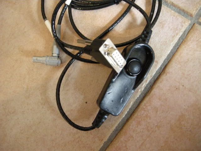
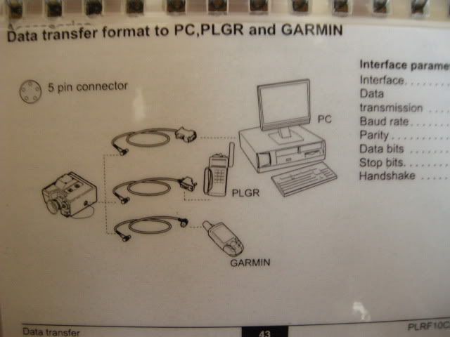
The aim was to try to run two different programs with two GPS, one internal and one external, select / deselect satellites that could worsen the reception / accuracy, stop the BT connection and see how it works again, battery replacement, use of the module AA battery back-up, coordinated detection of a target measured with the PLRF 10 C starting from the current position.
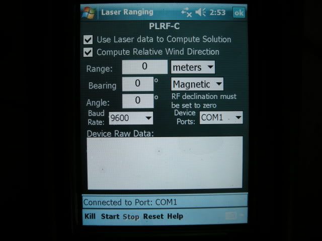
First operation PLRF 10 C compass calibration with 12 points in the process .. the result was GOOD 0 / 2 ° ... I have also seen in the past good 0 / 1 °........... the calibration procedure needs 20 seconds and you have to follow the instructions on the PLRF screen.
Kestrel compass calibration Kestrel ........ positive ... needs little more time than the rangefinder.
then using a specific software NOMAD I pointed out how the satellites were received, say that one could be cleared because of low precision, but I purposely left out the operation to see what was out in the end.
All GPS satellites have engaged immediately, leads to 30 seconds ....... but this is still a given variable, sometimes it takes even 3 / 4 minutes.
I compared the data of the nomad gps with those of another GPS Garmin rhino and the data were accurate.
However, the GPS data are not always constant and vary over time ... the tolerances are even a few meters away ...... and pretty constant if you check a position also when for exmple a month is expired.
if you try to do more operations at a time with the doors of the NOMAD with sudden changes you can have some conflicts etc etc ... blocking everything.
But doing a simple reset and wait for 5 minutes to restore the initial conditions and set the settings are not lost.
Tried 5 times ........ Always OK.
Intentionally caused the loss of the BT connection with the Kestrel ... comes a time out message ... and then just take the connection is restored in an almost immediate.
its battery life is connected with everything over 15 hours ..... I tried to connect the module with AA and everything connected with this unfortunately takes less than an hour ....... But it is true that the GPS or other can be connected only need arises and thus the duration increases significantly .. (I speak of the AA form) if you disconnect the rest of what is not needed is the last handheld I would say forever ..
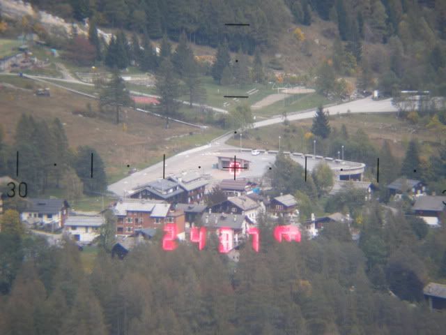
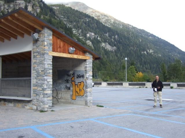
then laser at a target 2436 meters ...... (Maximum distance measured was 2560 m) ... it was a sort of garage in the middle of a square ... and other targets.
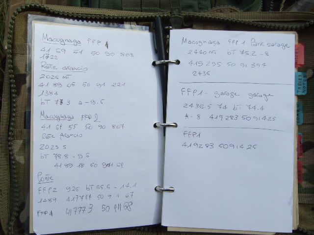
I have the program calculate the UTM coordinates of the target and then once I went down to check whether the accounts came back .. for the first two were out of phase for the latitude of about 10 meters ..
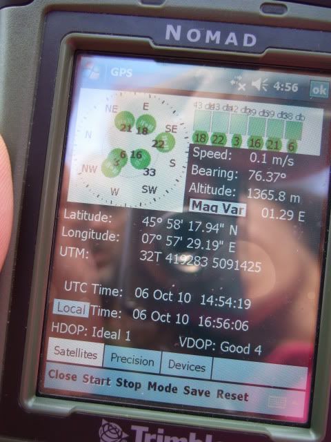
while the farthest was pretty much like ... in the photo that you will see where to get the value that I calculated I had to place myself ...... say just a few meters of lag considering I was almost at the maximum beam range combined with the errors of the GPS.
GPS height with versus altimeter reading was pretty the same.
during climb

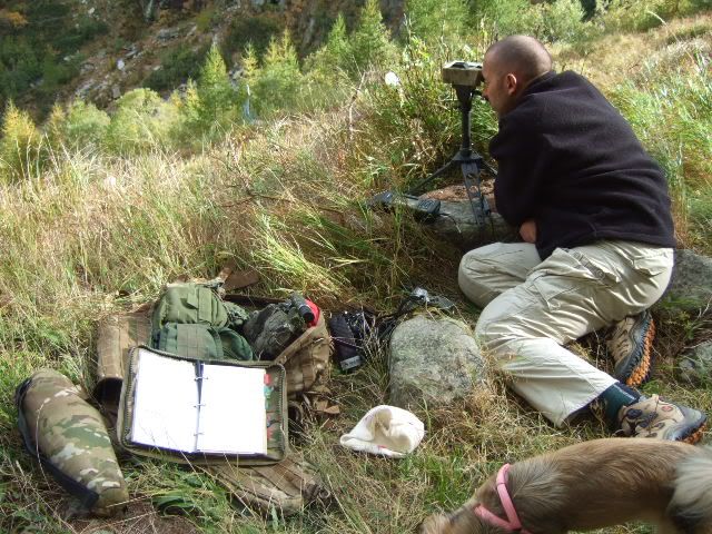
into position
target at 2436 meters
notes on my logbook
UTM position checked downrange
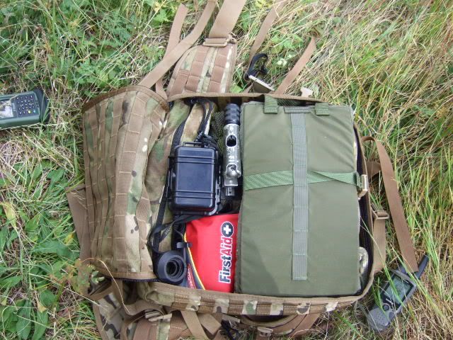
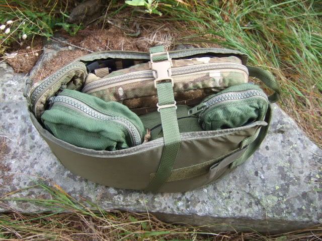
Kifaru marauder with a custom molle organizer always Kifaru with a mixed pockets, to have all my stuff packed and stable
my dog..... with a very strange behavior...all the time with a stone in the mouth... like the squitter in the movie the ice age..

during climb I've seen some clouds build up, so better to stop at an intermediate step, the place was good to do the test.
The aim was to try to run two different programs with two GPS, one internal and one external, select / deselect satellites that could worsen the reception / accuracy, stop the BT connection and see how it works again, battery replacement, use of the module AA battery back-up, coordinated detection of a target measured with the PLRF 10 C starting from the current position.
First operation PLRF 10 C compass calibration with 12 points in the process .. the result was GOOD 0 / 2 ° ... I have also seen in the past good 0 / 1 °........... the calibration procedure needs 20 seconds and you have to follow the instructions on the PLRF screen.
Kestrel compass calibration Kestrel ........ positive ... needs little more time than the rangefinder.
then using a specific software NOMAD I pointed out how the satellites were received, say that one could be cleared because of low precision, but I purposely left out the operation to see what was out in the end.
All GPS satellites have engaged immediately, leads to 30 seconds ....... but this is still a given variable, sometimes it takes even 3 / 4 minutes.
I compared the data of the nomad gps with those of another GPS Garmin rhino and the data were accurate.
However, the GPS data are not always constant and vary over time ... the tolerances are even a few meters away ...... and pretty constant if you check a position also when for exmple a month is expired.
if you try to do more operations at a time with the doors of the NOMAD with sudden changes you can have some conflicts etc etc ... blocking everything.
But doing a simple reset and wait for 5 minutes to restore the initial conditions and set the settings are not lost.
Tried 5 times ........ Always OK.
Intentionally caused the loss of the BT connection with the Kestrel ... comes a time out message ... and then just take the connection is restored in an almost immediate.
its battery life is connected with everything over 15 hours ..... I tried to connect the module with AA and everything connected with this unfortunately takes less than an hour ....... But it is true that the GPS or other can be connected only need arises and thus the duration increases significantly .. (I speak of the AA form) if you disconnect the rest of what is not needed is the last handheld I would say forever ..
then laser at a target 2436 meters ...... (Maximum distance measured was 2560 m) ... it was a sort of garage in the middle of a square ... and other targets.
I have the program calculate the UTM coordinates of the target and then once I went down to check whether the accounts came back .. for the first two were out of phase for the latitude of about 10 meters ..
while the farthest was pretty much like ... in the photo that you will see where to get the value that I calculated I had to place myself ...... say just a few meters of lag considering I was almost at the maximum beam range combined with the errors of the GPS.
GPS height with versus altimeter reading was pretty the same.
during climb
into position
target at 2436 meters
notes on my logbook
UTM position checked downrange
Kifaru marauder with a custom molle organizer always Kifaru with a mixed pockets, to have all my stuff packed and stable
my dog..... with a very strange behavior...all the time with a stone in the mouth... like the squitter in the movie the ice age..
")