Looks like a slice of heavenIt’s around the point to the left which is blocking the view to the rest of the lake. The tourists have mostly gone, but this weekend will be the last blast for them. Then all the locals start enjoying the place.
Grass lake
View attachment 7137971
Join the Hide community
Get access to live stream, lessons, the post exchange, and chat with other snipers.
Register
Download Gravity Ballistics
Get help to accurately calculate and scope your sniper rifle using real shooting data.

Install the app
How to install the app on iOS
Follow along with the video below to see how to install our site as a web app on your home screen.
Note: This feature may not be available in some browsers.
You are using an out of date browser. It may not display this or other websites correctly.
You should upgrade or use an alternative browser.
You should upgrade or use an alternative browser.
Photos The view does not suck..
- Thread starter 3-0-hate
- Start date
Some good neat places on the Small Eastern Mountains


Last edited:
Looks like a slice of heaven
It is a neat place. Pretty special regardless of season. Hard to access in the wintertime though. It’s called Woods lake in Alpine county California. I think I posted an early/mid spring photo of this very spot in the first page or two of this thread.
That's one thing I always loved about being out there, the water is so clear you can see so clearly down deep. logs down on the bottom that have been there fifty or more years.
I could swear I swam out to those rocks, in the lower pic, at some time in my younger years. Or, climbed out of a canoe and fished them.
Have you been up to Raymond? Rumor has it every year the record golden is in there. ?It is a neat place. Pretty special regardless of season. Hard to access in the wintertime though. It’s called Woods lake in Alpine county California. I think I posted an early/mid spring photo of this very spot in the first page or two of this thread.
I thought I might mention my wife's family was related to Milt and Marie Sorenson. That's where we stayed for three days on our first honeymoon.?
Added: that was honeymoon Pt. I. Which was supposed to be "girl stuff". Honeymoon Pt. II was supposed to be "man stuff" and that was held in central Nevada. Pt. II almost caused divorce.... As of Sept. 19th, what followed was 32 years of captivity.
Last edited:
Have you been up to Raymond? Rumor has it every year the record golden is in there. ?
I thought I might mention my wife's family was related to Milt and Marie Sorenson. That's where we stayed for three days on our first honeymoon.?
Added: that was honeymoon Pt. I. Which was supposed to be "girl stuff". Honeymoon Pt. II was supposed to be "man stuff" and that was held in central Nevada. Pt. II almost caused divorce.... As of Sept. 19th, what followed was 32 years of captivity.
Raymond doesn’t ring any bells for me. Is that a river or a lake?
Last edited:
It's a peak and a lake. If you looked to the south from Markleeville, you see the two most prominent peaks. The one on the left is Silver Peak, the one on the right is Raymond.Raymond doesn’t ring nay bells for me. Is that a river or a lake?
You could get to the base of it by driving out toward Blue Lakes via 88 and Hope Valley. About 1/2 mile before you get to Blue Lakes turn left and follow the road out to Sunset Lakes (upper/lower). The peak directly to your east is Raymond. Anyhow, there you catch the Pacific Crest Trail and follow it around the north end of Raymond. There's a sign and a short trail leading up to Raymond Lake. It's right under the Peak.
Added: My wife and I got married in the meadow right above Markleeville, on Ted Bacon's ranch. She worked for him when she was in high school. Perfect day. A storm came in three days before the wedding and dumped a bunch of snow on Raymond and Silver. But, it was a beautiful 70 and sunny on the day of the wedding.
Last edited:
Damn at the views!!! Some of you guys are very lucky indeed.
I wish i had the land, time and money to be able to get out in nature and enjoy it like that.
I wish i had the land, time and money to be able to get out in nature and enjoy it like that.
The cool thing about a lot of land out west is it's public. Go there, and enjoy. But, take care of it so you can always go and enjoy it.Damn at the views!!! Some of you guys are very lucky indeed.
I wish i had the land, time and money to be able to get out in nature and enjoy it like that.
Last edited:
Lake Almanor in Northern CaliforniaDetails?
It's a peak and a lake. If you looked to the south from Markleeville, you see the two most prominent peaks. The one on the left is Silver Peak, the one on the right is Raymond.
You could get to the base of it by driving out toward Blue Lakes via 88 and Hope Valley. About 1/2 mile before you get to Blue Lakes turn left and follow the road out to Sunset Lakes (upper/lower). The peak directly to your east is Raymond. Anyhow, there you catch the Pacific Crest Trail and follow it around the north end of Raymond. There's a sign and a short trail leading up to Raymond Lake. It's right under the Peak.
Added: My wife and I got married in the meadow right above Markleeville, on Ted Bacon's ranch. She worked for him when she was in high school. Perfect day. A storm came in three days before the wedding and dumped a bunch of snow on Raymond and Silver. But, it was a beautiful 70 and sunny on the day of the wedding.
I found it. Looks like I’ve been very near that before, but never quite there. Hunted the area southwest of there last year. Pretty rare I get past the blue lakes though.
The area Southwest of there is one of the few places I've found a LOT of mountain quail. It's rare you see them in other places, come back with the shotgun and they are still in the area.I found it. Looks like I’ve been very near that before, but never quite there. Hunted the area southwest of there last year. Pretty rare I get past the blue lakes though.
The area Southwest of there is one of the few places I've found a LOT of mountain quail. It's rare you see them in other places, come back with the shotgun and they are still in the area.
That’s good to know, mountain quail opens this weekend.
Here’s a contrast to the gloomy version from the last page

Straight top knots and just a whistle. No call like California or Gambels. Just a quick, low key whistle.
Nice pic of the dog. It always seems when a dog is going to get their picture taken they automatically get that goofy dog look. ?
Nice pic of the dog. It always seems when a dog is going to get their picture taken they automatically get that goofy dog look. ?
Some mighty big trout in that lake.Lake Almanor in Northern California
That’s one of my bucket list birds. Only seen them near leviathan. Saturday I’ll try my luck. Been trying for Sooty Grouse the last few weeks. Always find birds, but they have an uncanny ability to present a shitty shot opportunity.Straight top knots and just a whistle. No call like California or Gambels. Just a quick, low key whistle.
Nice pic of the dog. It always seems when a dog is going to get their picture taken they automatically get that goofy dog look. ?
Snapped this pic of the cliffs above Brooks Lake in Wyoming on Labor Day. Almost 25 years and 60 pounds ago I took a photo from the top of the cliffs looking back towards the wilderness area.

Florida Hunting: The land is flat, the deer are small, the turkeys are plentiful and the hogs run wild....
View attachment 7149675
Izzat the honey hole?
It's pretty
This view didn't suck. Hiking in Glacier a couple years ago with my son.

Just an observation about this thread. Some are beautiful pictures of the great outdoors, others are of a place that is meaningful to the poster. But there comes a time in everyone's life where just waking up and seeing "something" is a view that doesn't suck.
I'm just saying.........
I'm just saying.........
Zero mountains in South Texas, but we get some cool sunrises. About 5 mins before legal shooting light teal season 2019.
Sunrise in the Gulf of Mexico before taking a chopper home

DIY Kodiak hunt with a buddy of mine. He is a redident and drew a great tag so we went in for 11 days. Killed that guy on the last day.


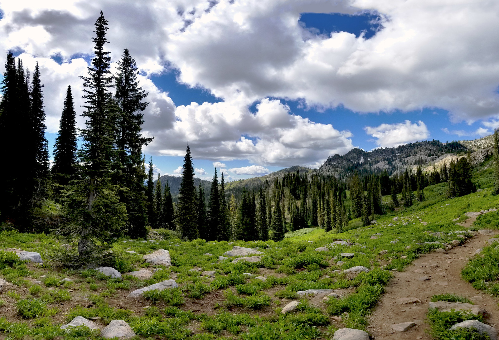
I did a short hike to an alpine lake about an hour and a half away from my house today. 7300' elevation combined with a very steep incline to get back out = I need to get into better shape for hunting season. The views were definitely worth it though, even if the fish weren't biting.
Trail leading to the lake. About 1/3 the way there.
Almost there. Destination in sight.
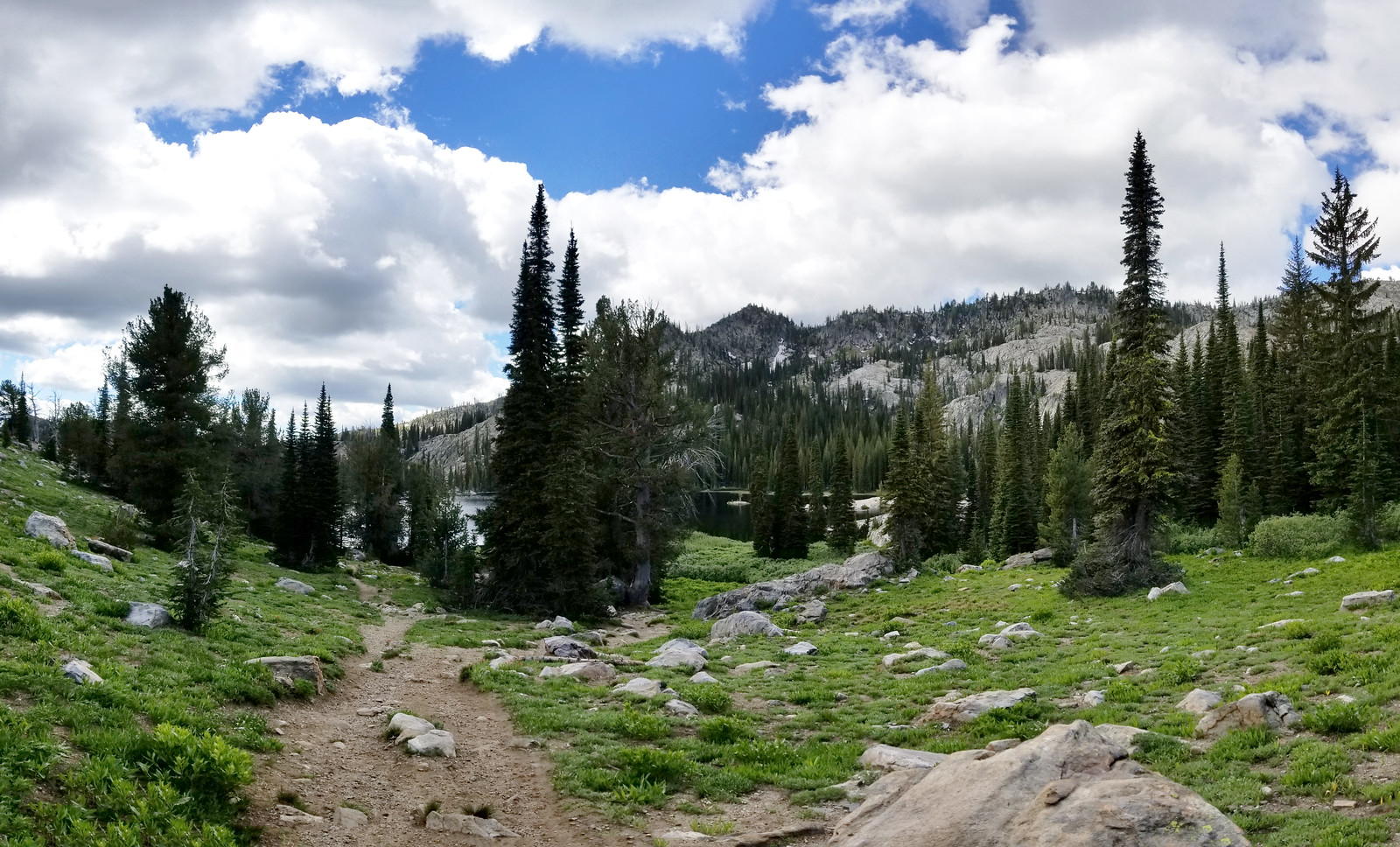
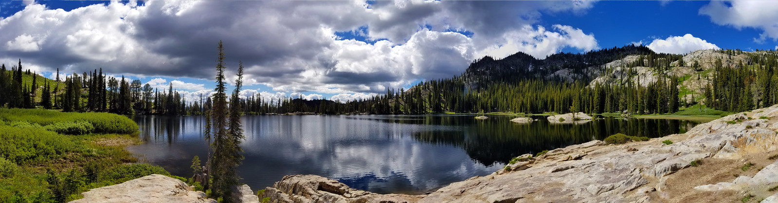
The reward:
Nice, looks a lot like moose lake outside of Lake City, CO, just bigger. What lake is that?
Nice, looks a lot like moose lake outside of Lake City, CO, just bigger. What lake is that?
This one.

Lake San Cristobal.
Ha. Not much hiking to get there so doubt that’s it.
Ha. Not much hiking to get there so doubt that’s it.
Can't find a Moose Lake near Lake City.
Can't find a Moose Lake near Lake City.
Sorry, Deer Lake(s) on the map.
Looking for muleys in Nebraska. My state is underrated for it's views.

Looking for muleys in Nebraska. My state is underrated for it's views.View attachment 7188039
This is true.
I constantly look at these pics trying to figure out where I’m going to retire after military life
Beautiful....but it doesn't count unless you tell us where it is! ?One of my happy places
Beautiful place. I showed my wife and we looked it up. Although I had been up and down US 95, I hadn't been to Hell's canyon. So, in looking at the reviews, one guys bitches about the 17% grades to get there! Really??? Should they (god ,or whomever one worships ) have created Idaho flat?This is in Idaho, looking down at Pittsburg landing.
She went on to find a "one-star" review of all the national parks. Yellowstone got one because a guy only saw a bear there at about a thousand yards. Geysers don't mean much after you've seen one Etc. Yosemite got one because all the burned trees took up parking space. Of course, big cliffs....so what.
Wow! just WOW! What is it going to take to impress Americans from now on?
Very true. The sandhills of Ne and Co, once you understand them, are absolutely special.Looking for muleys in Nebraska. My state is underrated for it's views.View attachment 7188039
These are seen on my daily walk with my dog in our 'hood. We're on a hill/plateau (5170') that gives some nice views.
Pikes Peak (14,110') on the far left and Denver (5280') on the right. The mountains in between (green) are just the foothills and only appear to be close to height to Pikes Peak because they are so much closer. Pikes Peak is approx. 74 miles away, Denver about 10miles, and those foothills are likely 35-40 miles away.

Mt. Evans, 14,264', on the right is about 45 miles away.

Pikes Peak (14,110') on the far left and Denver (5280') on the right. The mountains in between (green) are just the foothills and only appear to be close to height to Pikes Peak because they are so much closer. Pikes Peak is approx. 74 miles away, Denver about 10miles, and those foothills are likely 35-40 miles away.
Mt. Evans, 14,264', on the right is about 45 miles away.
Last edited:
Damn, the area between Evans and Sugarloaf is one of my favorite places on this planet. If you get the chance, crawl around on Blackwolf.These are seen on my daily walk with my dog in our 'hood. We're on a hill/plateau (5170') that gives some nice views.
Pikes Peak (14,110') on the far left and Denver (5280') on the right. The mountains in between (green) are just the foothills and only appear to be close to height to Pikes Peak because they are so much closer. Pikes Peak is approx. 74 miles away, Denver about 10miles, and those foothills are likely 35-40 miles away.
View attachment 7197977
Mt. Evans, 14,264', on the right is about 45 miles away and Mt. Elbert, 14,439'.
View attachment 7197976
A panorama of the local mountain range here in the treasure valley. Taken at the highest point in Meridian Idaho, looking out over west Meridian and Boise.
FYI Resolution is 17512x3851 if you want to zoom in and look around
 Meridian Panorama
FYI Resolution is 17512x3851 if you want to zoom in and look around
Similar threads
- Replies
- 61
- Views
- 2K
- Replies
- 0
- Views
- 582
